
As well as walking both main routes of the Portuguese Camino north of Porto, including the Variante Espiritual, I’m happy to say that I’ve now walked to the “End of the World” on the Camino de Finisterre and Muxía, which starts in Santiago de Compostela.
I’m becoming a bit of a Camino de Santiago addict, which anyone who has followed one of the pilgrim trails to or from Santiago de Compostela in Spain is likely to relate to. Not only are the routes usually very well marked, interesting and scenic, the sense of camaraderie among fellow travellers plays a major part in the overall experience.
Not sure what the Camino is? Read all about the Camino Português
Most people end their Camino at the cathedral in Santiago but some choose to continue their journey for another few days to reach the coast on the Camino Santiago Finisterre.
If you’re thinking of doing the Coastal Portuguese Camino but can’t start in Porto, consider this instead as you spend quite a lot of time by the water.

Whether you add it to your main Camino or choose to just focus on the Santiago – Finisterre – Muxía route, I highly recommend doing it. My friends and I loved every minute of the experience.
What is the Camino de Finisterre and Muxia like?
This is what to expect, based on what we did, i.e. a self-guided walk using the services of a local tour operator to organise our accommodations and luggage transfer as well as provide an in-person briefing, detailed route notes and 24/7 emergency support.
Interested in this kind of service for your Camino? Get a quote here.
Stage 1: Santiago de Compostela to Ponte Maceira (approx 17 km / 10.5 miles)
After spending a couple of days in the beautiful city of Santiago de Compostela, we took some last photos in front of the cathedral and left the city via the Trinity Gate. We were soon in quieter neighbourhoods and, after seeing the first milestone with a countdown towards Finisterre, into woodland.

We stopped at the village of Sarela de Abaixo for a last glance at the distant towers of Santiago de Compostela Cathedral then we were back in woodland again, interspersed with a few small villages.


At one point, we spotted the word ‘Ultreia’ marked out in stones, with a miniature dolmen as reference to the many prehistoric burial sites in this part of Galicia.

Ultreia is a Latin word meaning ‘beyond’ and is used as a greeting among pilgrims, although you’re more likely to hear “Buen Camino!”. While the latter simply means “Have a good Camino”, “Ultreia!” is more like “You Can Do It! or “Keep Going!”.
Look out for Fisterra Bovine World in Trasmonte, which has distinctive murals of cows on its outbuildings.

This unique project matches bovine breeds from all over the world then raises their offspring using the traditional Galician livestock system. As well as eating corn-rich feed while they grow into mature cows, the cattle are then fed only with native corn for the final 6-month fattening period. Hence the amount of corn growing in this area.

Ponte Maceira is a beautiful village, one of the most attractive in Galicia, with mansions and other attractive buildings on either side of the Tambre River. Its iconic bridge was built in the 12th century and uses the pillars of a previous Roman bridge as its support.
According to the legend, which is depicted in the local council’s coat of arms, God destroyed the original bridge with a single blow to prevent Roman soldiers stationed in nearby Dugium (now known as Duio, in Finisterra) from pursuing the disciples of St. James.

Practicalities
We had a delicious lunch at Restaurant Pontemaceira, which overlooks the weir. Note that they are trying to keep their standards high so they have quite a few rules about pilgrim behaviour and it’s not cheap but it was defintiely worth it for us. Luckily, we weren’t too dishevelled or smelly to be allowed in!
There were cafés at decent intervals so we had plenty of comfort breaks and a caffeine hit to get us up the hill from Aguapesada to Trasmonte. One of the cafes, O Cruceiro, is quirky to say the least.
We ended our walking day in Ponte Maceira, although many pilgrims continue to Negreira. The accommodation in Negreira falls short of our tour operator’s standards so we stayed in a country house hotel in a small village nearby.
Day 2: Ponte Maceira to Santa Mariña (approx 25 km / 15.5 miles)
None of us were particularly looking forward to such a long walking day but it wasn’t as bad as we feared. This was our longest stage but we met people who had arranged their Camino Finisterre with a different tour operator and had a couple of 33+ km days in store! Not for me, thank you.
We started where we left off, in Ponte Maceira, enjoying the views as we crossed the bridge. A couple of villages and some pretty forest later and we were in Negreira, a small town with all the necessary shops, banks and services.
The main sight in Negreira is the 14th century Pazo do Cotón, the arches of which you’ll walk through on your way out of town.

We were quite struck by the poignant sculpture at the far end of Plaza do Cotón. It depicts a local man leaving his family as he emigrates in search of a better life for them all. This was a common occurrence in Galicia, and Portugal.

After Negreira, we started the long but gradual climb through the woods, hamlets and fields to Piaxe then down to Vilaserio.

The local economy is largely driven by agriculture and livestock so you’ll see, and smell, plenty of cows and cornfields in this area, as well as hills and forests. The scenery reminded me a lot of North Wales, where I grew up, except for the cornfields.

Practicalities
Note: If 25 km in one day is beyond your capabilities, there are ways around this. Get help planning your Camino de Finisterre.
Although we stopped in Negreira to buy bread, we messed up slightly by missing the chance to stop at the Albergue café in Piaxe so the next opportunity was in Vilaserio.
We didn’t stay overnight in Santa Mariña – our tour operator arranged for a transfer to take us to a lovely country house hotel instead.
Day 3: Santa Mariña to Olveiroa (approx 12.5 km / 8 miles)
The walk from Santa Mariña was fairly easy – the most challenging part being the climb up Monte Aro. The views were well worth the effort though. There are some binoculars near the top of Monte Aro so that you can get a better look at the Fervenza Reservoir and surrounds.

On the way to Corzón there are lots of information boards about the archaeological finds in this área, such as megalithic dolmens. These stone burial chambers, like the one called Pedras Miudas, date back to the 3rd century BC.
Unfortunately, the signs don’t indicate how far from the Camino you have to walk to find one so I gave up after a couple of hundred metres.

In Ponte Olveira I spotted the first of what turns out to be many mosaics of the Camino Finisterre Muxia. Look out for more in Corcorbión, Cee and Finisterre.

Olveiroa, our base for the night, has a particularly high density of well-preserved stone granaries, a small church of St. James and a few establishments offering food and accommodation for weary pilgrims.

There are also a couple of posters with menacing wolves and the word Vákner on them but it wasn’t until the following day that I understood what that was all about.
The Vákner turns out to be a mythical werewolf-type beast that an Archbishop from Armenia spoke about when he returned from his Camino de Finisterre and Muxia in the 15th century. There’s a spectacular sculpture of this creature a few kilometres into the next stage.
Practicalities
There were plenty of cafés at intervals along this stage and we got to Olveiroa in time to have a pilgrim menu for lunch.
After a long walking day the day before, I would not have wanted to do what many pilgrims we met were aiming for, which was to walk all the way to Finisterre in one day (approx 35 km!).
Day 4: Olveiroa to Cee (approx 17.5 km / 11 miles)

I absolutely loved the majority of this stage, which was fairly easy and very beautiful. I especially enjoyed the gentle climb through the wind farm and then the views above the mist that was still lingering in the Xallas River Valley.

About 6 kilmoteres into the stage, the route splits, depending on whether you want to head towards Finisterre or Muxía.
We were advised that it’s better to go to Muxía first, so we did, although we encountered plenty of pilgrims doing it the other way around. Having walked the hills, I am glad we started with Finisterre.

At the cross and junction in Marco do Couto, we saw the massive Vákner sculpture and had fun posing on the pilgrim bench before continuing.

After that, we reached a level, open section with views to the ocean – we could just about make out the capes of Corcorbión and Finisterre in the distance.

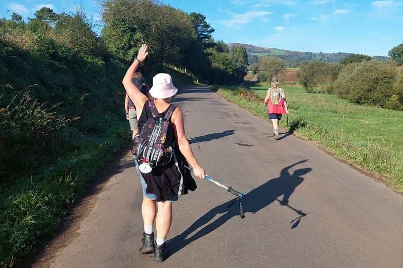
After passing the chapels of Our Lady of the Snows and Saint Peter the Martyr, the steep descent towards the town of Cee begins. We had been warned about this so we had a rest before getting stuck into it, and made good use of our hiking poles.


Cee is a lively town with a beach backed by a park, right in the centre. Disappointingly, the water is not suitable for swimming so we made do with a paddle and a chat with some locals.

Like so many towns and villages in this part of Galicia, Cee was largely destroyed by Napoleon’s French troops in 1809 but there are still some older buildings dotted around and the parish church of Our Lady of Xunquera was built on top of the original 15th century Gothic building.

Praza da Constitución is a short avenue of plane trees which had an interesting photography exhibition when I walked through. There’s also a monument to the Camino and its pilgrims in the form of massive walking boots and a staff with the scallop shell.

I was particularly excited to spot a Sargadelos ceramics shop. I’d seen several bars with beautiful and distinctive ceramic beer pumps and discovered that they are made by this Galician company, which was originally founded over 200 years ago and experienced a revival in the 1970s.
I bought myself an amulet as a souvenir – go into the Aurora sports shop to ask someone to open up for you if you want to shop at Sargadelos too.

Practicalities
There are no cafés between the 5.5 km point and Cee so you’ll need to stock up on water and supplies before the route splits in two directions.
Day 5: Cee to Finisterre (approx 16 km / 10 miles)
This stage was another highlight of the Finisterre Camino for all of us, especially the time we spent at Langosteira beach.

The route starts by following the coast to the next village, Corcorbión, which has some interesting buildings, including the tourist information office, which was once a prison, and the Neo Gothic church of San Marcos da Cadeira.


After climbing the first hill of the day, we stopped for a coffee at the beautiful Playa de Estorde.

The coastline in this part of Galicia is so beautiful that we made a slight detour from the Camino in Sardiñeiro de Abaixo to follow the walkway beside Playa de Sardiñeiro before continuing on the Camino through a forest.
Once this opens up, you get a spectacular view to the Finisterre headland. It’s quite a steep descent but not too long and then 2 km of beach awaits.

Like many other pilgrims, we chose to abandon the Camino, which runs parallel to Langosteira beach in favour of walking on the sand. We also went for a dip, which was delightful – bring your swim stuff!


After the fun on the beach, it’s a fairly short walk into the centre of Finisterre, where we stopped to get our certificates and visited the Lonxa, the wholesale fish and seafood auction that takes place Monday to Friday from 4:30 pm.

Sunset was due to happen at around 8:15 so we set off for the lighthouse in plenty of time, making a stop at the beautiful Santa Maria de Aereas church on the way. This 12th century Romanesque church has Gothic elements inside and some wonderful sculptures behind the altar.


We met plenty of other pilgrims on the 3 km stretch to the Santiago Finisterre Camino Kilometre 0 milestone where we had the obligatory photo stop before finding a rock to sit on for the sunset.

Some people end their Camino in Finisterre, although we continued to Muxía. It largely depends on how much time you have but if you can spare 2 extra days to walk to Muxia, it’s worth doing in my opinion.
Practicalities
There are cafés at useful intervals along this stage and it’s not particularly challenging except perhaps the descent to Langosteira beach.
If the weather is good, I highly recommend going for a swim and timing your walk to the lighthouse for sunset.
Day 6: Finisterre to Lires (approx 13.5 km / 8 miles)
This was a nice easy day, busy with pilgrims heading in both directions. We started by heading back to Langosteira beach and turned left at the cross to follow the road out of town.

The views across the bay were lovely. After passing the church of San Martiño de Duio, we continued on country lanes towards the next hamlets, one of which has a new café that we hadn’t anticipated but were grateful to spot.

From there, we headed into woodland for a long but steady climb – look out for a cross tucked away in the trees. This is definitely a rural day, with no major sights but lots of beautiful scenery.

At one point, we spotted a field of cows and eventually realised that the man standing near the gate was telling us to get off the path because the cows were about to be driven home for milking. One of our group sheltered behind a Muxia Camino milestone as about 20 cows filed past her!

Lires itself is a small village with several accommodations and eateries.

Once we had freshened up and the rain eased off, we went down to Lires beach for a spot of beachcombing. We also spotted a local man digging in the sand for shellfish.

Currents can be quite strong here so swimming is not recommended. If you do want to go swimming, ask at your accommodation about safer spots.
Day 7: Lires to Muxía (approx 15 km / 9.5 miles)
We were sad to be setting off on our last walking day – we’d all had such a great time that none of us wanted it to end.
Shortly after leaving Lires, we crossed the bridge over the Castro River. Until 2010, this crossing was made using the stone blocks that you can still see in the water.

Again, there are no major sights until you reach Muxía but the walk is pleasant and not too taxing, despite being mostly uphill for the first 8 kilometres.

We spotted a very unusual plant at one point.

Playa de Lourido beach is just before Muxía but we decided against a detour for a swim as the sea looked quite rough.

Look out for tiny walled vegetable gardens as you get closer to Muxia – I imagine it’s quite challenging growing crops so close to the sea.

Muxía itself seems a bit odd when you first enter the streets of low level houses as there doesn’t seem to be any real centre of town. Most activity seems to be near the Marina and the tourist information centre is not far from here so you can go and collect your extra certificate.
Muxia’s main draw, and the official end of this stage, is at the Sanctuary of Our Lady of the Boat, about 1 km from the marina.

According to the legend, the Apostle James was feeling despondent about his mission to convert the local population of sunworshippers to Christianity. He came to the rocky headland to ponder the situation and the Virgin Mary came to him in a stone boat. She told him that he had done his part and that it was time to return to Jerusalem.
The Santuario da Virxe da Barca has some beautiful stained glass windows that allude to this legend, as well as several ships dangling around. There’s a small gift shop in the sacristry and you can get your pilgrim passport stamped there too.
Some of the rocks in front of the 18th century sanctuary are said to be part of the Virgin’s stone boat, namely Pedra de Cadris, which resembles a sail, and Pedra da Abalar. The sail stone is believed to help cure rheumatism while the other, which wobbles a bit, is used to decide whether an accused person is guilty of the offense or not.

For me, the healing powers came from watching the waves pound the rocks and the sunlight glittering on the ocean. I spent a good couple of hours appreciating the majesty of nature and contemplating life, love, the universe.

By the time we were ready to move on, the sun was slipping lower in the sky. We climbed the small hill of Monte Corpiño, which is a cluster of rocks behind the sanctuary that offers 360º views of Muxia and its headland. It’s an idyllic and moving spot to watch the sunset.


On the way back to our hotel, we made a detour to see the wooden racks that Pedriña use to dry and cure conger using an age old artisanal method. These, and the Cascóns racks near Santa Maria church, are the only remaining ones in the Iberian Peninsula.

I noticed a couple of small beaches on the other side of the headland as we were leaving Muxia the following day. They looked sheltered enough for swimming but check with locals before taking the plunge.
Practicalities
There are no cafés on this stage until you reach Múxia, although there was a toilet and vending machine at around the 3 km point with a tips bowl and another honesty bar a bit further along.
Depending on how much time you have, and whether or not you’re staying overnight in Muxia, you may want to have lunch and freshen up at your accommodation before you walk the final leg to the sanctuary.
Do you get a pilgrim certificate for the Camino de Finisterre?
If you’re not bothered about qualifying for a compostela pilgrim certificate, which requires you to walk at least the last 100 kms (or cycle the last 200 kms) to Santiago, you can also just start the Camino Finisterre from Santiago de Compostela.
You can still get a certificate in Finisterre and another in Muxía but, although beautiful, they don’t carry quite the same weight as a compostela.
See this article for more about the compostela and all you need to know about the Camino de Santiago in Portugal.

